All posts by bpheasant

Grand Canyon North Rim & Rainbow Rim Trail

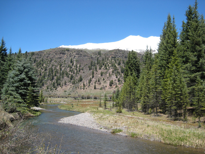
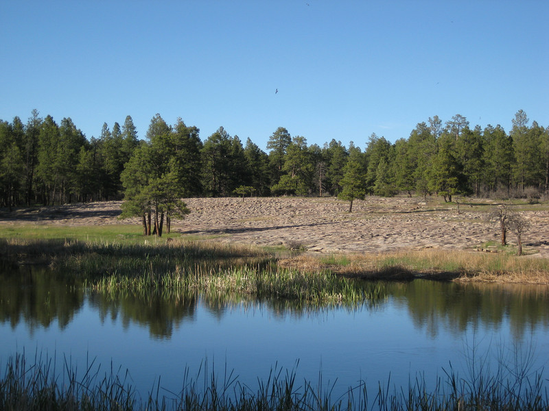
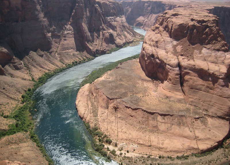
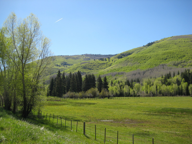
It was with great pleasure that I awoke to a lack of sound from the wind chimes – things were a lot calmer than yesterday.  We left town by 8.30 & headed west back into Utah briefly before dropping south back into Arizona & towards Grand Canyon North Rim.  Once we hit the small town of Fredonia I was back on roads I’d traveled before – the first time since Bragg Creek almost four weeks ago.  After a brief stop at Jacob Lake for me to get a forest road map & Valerie to buy more souvenirs, we were driving through the Kaibab Meadows.  It must have been cold there last night – there was still some fresh snow that hadn’t melted just yet, seems I can’t get away from the stuff.  With the long winter, all the spring growth was not completed & the meadows weren’t quite as pretty as last time I drove through – but they are a still a magnificent sight.

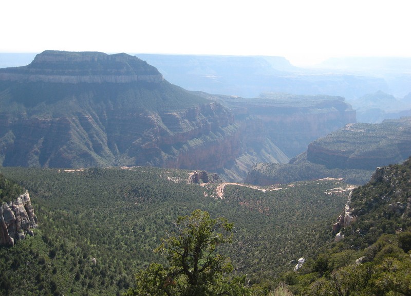
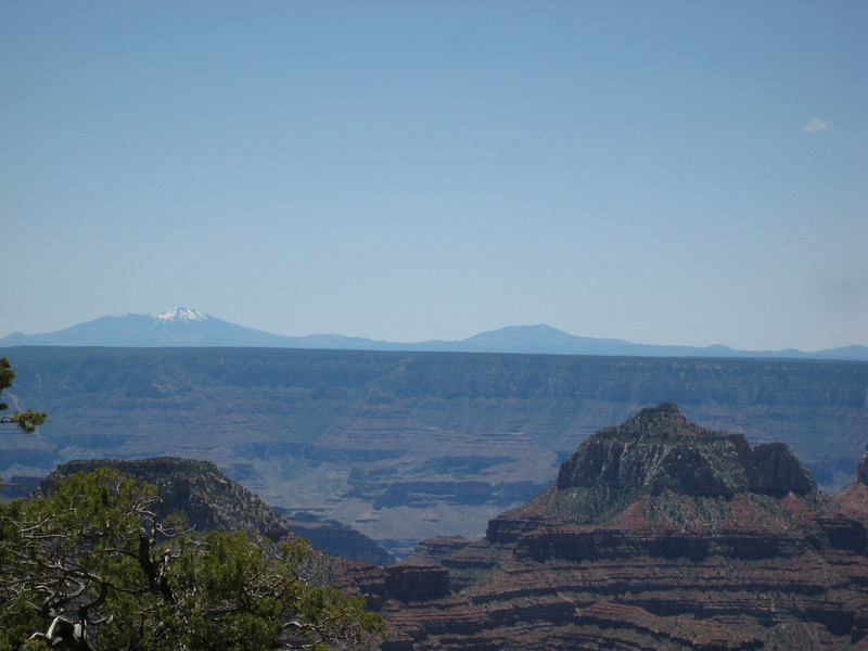
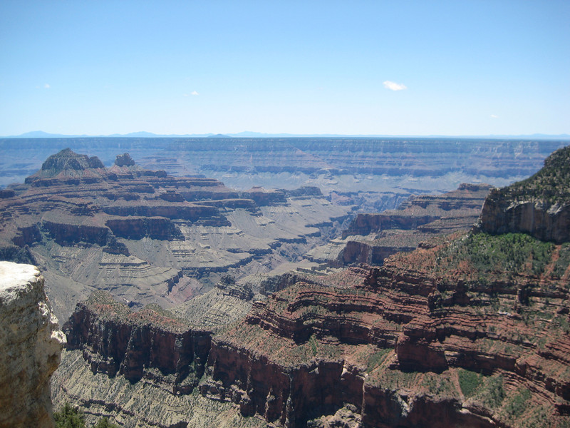
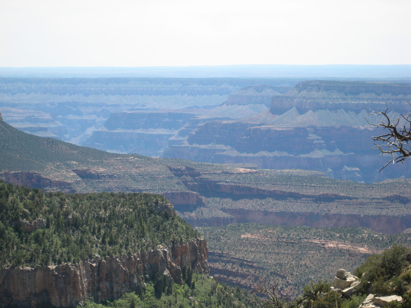
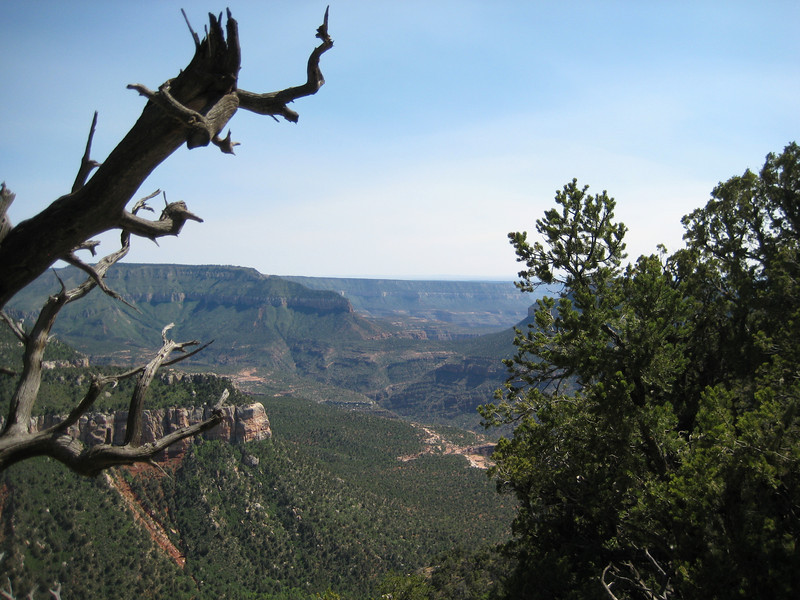
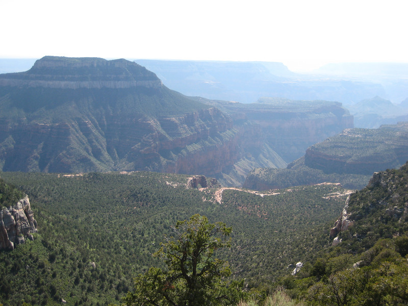
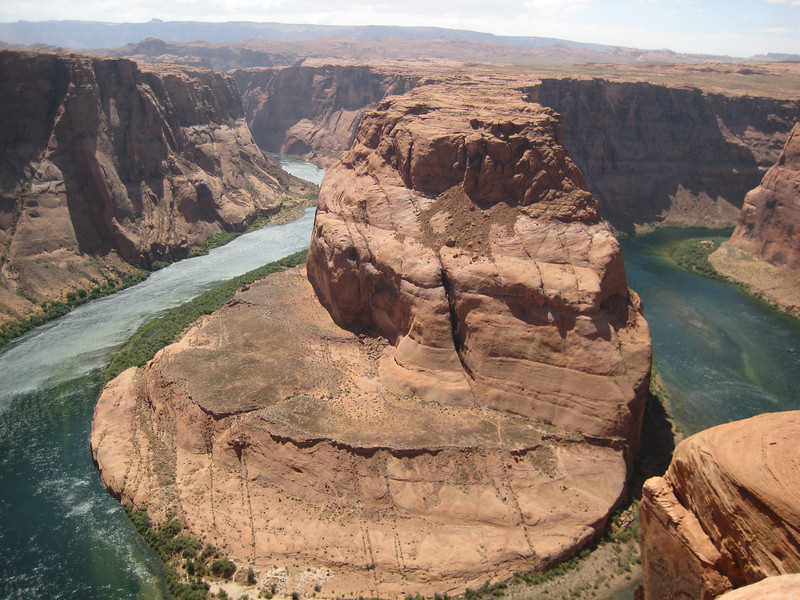
We didn’t stop too long at the rim, maybe an hour, to get a good view of various parts of the canyon.  The sky was wonderfully clear all the way down to the horizon & this enabled us to see some of the mountains a hundred-odd kilometres away – I don’t think I saw these last time.

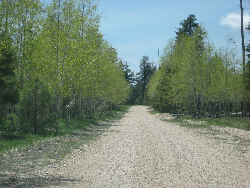
We drove out of the park & soon after turned onto Forest Development Road 22, continuing on for about 22 miles & 40 minutes to the Parissawampitts (I don’t know how to pronounce it either – I prefer Paris-saw-armpits) trailhead so I could get a ride in.

I was most excited to be riding along the rim of the Grand Canyon on good singletrack.  The trail in its entirety is almost 29 km to the Timp trailhead.  It forms a sawtooth route (roughly) to keep on a reasonably similar level by following all the little side canyons in & out.

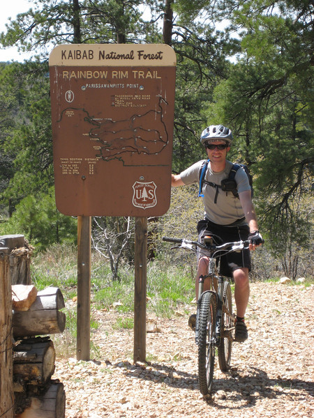
This was a great fun trail – I would grade the trail itself as beginner-intermediate level, but at the higher end of that due to the length & elevation (all between 2260 & 2270 m).  The start of it is rocky, but later on it’s mostly dirt.  You do spend a lot of time in the trees, but every so often you get a glimpse of the canyon & then all of a sudden there is a magnificent view that you can be sure not many other people ever see.  I had heard that there’s not much climbing, but there is a bit (apparently I did almost 600 metres all up) – but it’s all pretty easy (middle ring the whole time, & mostly in a small cog).  Despite having been up in the mountains for over a year, I was a just little shorter of breath than normal.  The last eight or so kilometres is great fun as it only has one decent climb in it & you can let it rip on the flatter sections.  I saw quite a few deer, some beautiful birds & flutterbys (the bright yellow ones were the best) & something that may have been a marmot. Only hitch of the ride was losing the seal on my tubeless rear tire – a bit of rest while I had to go back to a tube.  Unfortunately the smog rolled in from California & obscured the view a little in haze.

Antelope Canyon & Horseshoe Bend

After yesterday’s busy day & a slight time change (AZ doesn’t do Daylight Saving – unless you work for the federal government or are on a reservation) we had a much less jam-packed day today. Which was just as well as that horrendous wind was back. They must really be copping it in tornado alley again, or are about to.

We had a 10.30 tour of Upper Antelope Canyon. Waiting around the parking lot the wind really picked up & all the sand it carried was soon stinging eyes & skin. After a ten minute drive in a Suburban up a wide sandy wash (flood water route) we were at the entrance to the canyon, at ground level.

We walked in to the quite skinny canyon – it is carved from Navajo sandstone by flash floods. With the sun high enough in the sky during the summer months, there were great shafts of light peeking through from above. With all the sand that the floods carry, the surface of the stone was smoothed & contoured in really nice ways. Unfortunately, with all the wind above it rained sand on us & our cameras quite a bit. Even I managed to get some nice pictures.

After lunch, we took a short trip out to Horseshoe Bend in the Colorado. Finally, after the sediment settling in the reservoir, the river is clear. It was even windier out here (about a one kilometre walk) & all the sand being blown around stung a lot – short, T-shirt & flip-flops/jandals wasn’t a great idea. I felt like I’d been (mildly) sandblasted & afterwards was in need of a human dedust system (shower sufficed). Still, the river was a deep green & very pretty as it made its big turn three hundred metres below us.

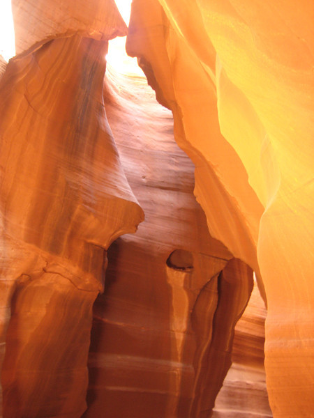
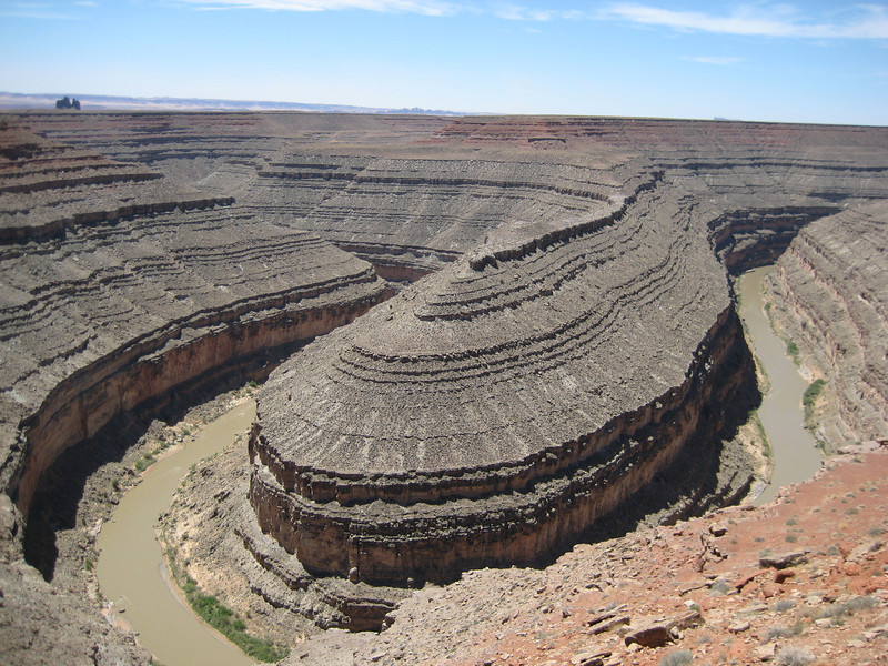
Wider angle would have been nice

The best thing was we didn’t get blown off the edge. On the off chance anyone else in interested in the vague route we are taking – the SPOT link at the top right of the page may interest you. I usually activate it at each new overnight stay, & occasionally at other significant places. When we sit still for a while in San Diego, I intend to compile a route map proper.  That is all, I need to develop my crazy plan of riding around part of the Grand Canyon (north) rim tomorrow & work out if it’s feasible.

4 Corners & Monument Valley

Cortez being in the south-west of Colorado is not all that far from 4 Corners – the only place in the States where four states meet in one place.  For some reason, I expected the area to be flat & desert – but we were soon driving up towards more small canyons.  We managed to get there before the rush & spend a bit of time mucking around in four states at once.

While Valerie perused the various stalls (the monument is on a Navajo reservation) of handmade jewelery, pottery & various other do-dads I had a look around & read up about the surveying history & why the state lines are where they are. Very interesting, but I would think that.

Our next stop was supposed to be Monument Valley, but we got a little distracted. First by Gooseneck State Park – where the San Juan River bends back & forth a bit. I could only think of gas plant changes, but I think I’ve lost all my NZ Steel readers – so that won’t make much sense to anyone. There were three or four good bends, but I couldn’t get them all in one shot so you’ll have to take my word for it.

Our next distracton was a little drive through the Valley of the Gods. Just off the highway, this dirt/gravel road was a great little adventure. It had some ridiculously little steep drops & climbs & got a bit skinny (of course, when we met the big pick-ups carrying little RVs on their trays). It was a fun drive & once again I was pleased to be in an Outback, not a minivan. The big rocks rising out of the valley were spectacular (I was too busy driving, so these pictures will have to suffice).

Back on the highway, it wasn’t long before we got some great views heading towards Monument Valley. I managed to get a few iconic shots, while not getting run over while standing in the middle of the highway.

The wind was really starting to pick up & we could see a haze of dust accumulating on the horizon. Monument Valley stradles the Arizona/Utah border & is also on a reservation, so we paid our fee, checked out the Visitor Center & then went on the seventeen mile self-drive tour. The road was orders of magnitude worse than the Valley of the Gods road, probably because it has so much more traffic on it. There were tour pick-ups (with bench seats on the back under a canopy – it was like being in Kenya on safari), some RVs, some buses & many little cars & SUVs. Bouncing around & getting out in the wind was OK for a while, but then got tiresome.

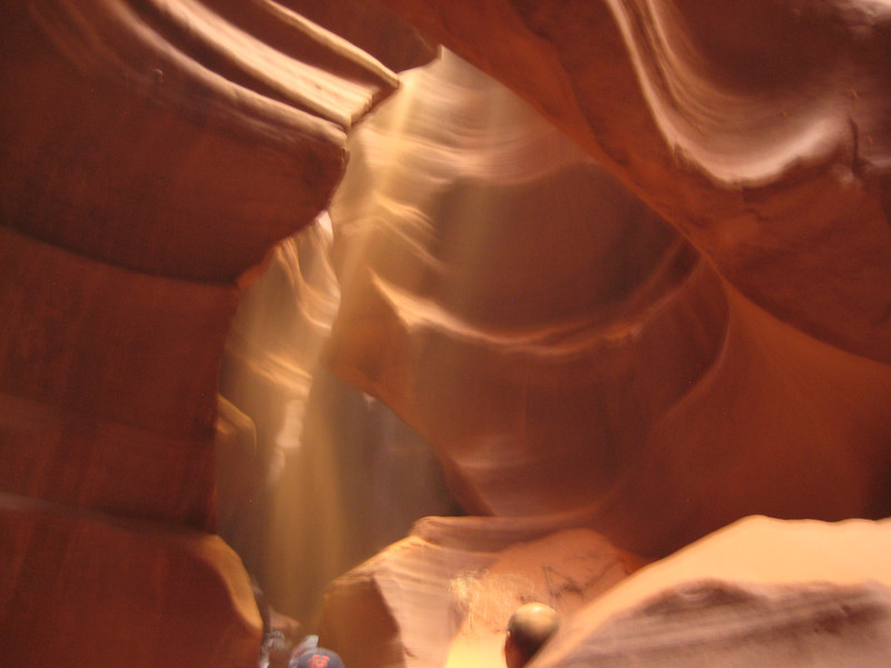
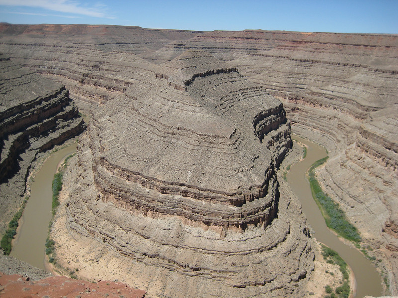
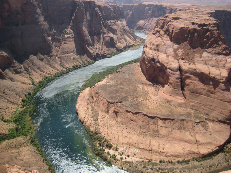
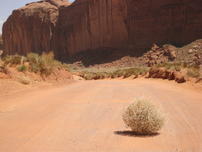
There were a lot of tumbleweeds blowing around – this is a small one, the car got sconed a few times by much bigger ones

With still a fair bit of driving to do, we headed off for Page, AZ. Only because Valerie had heard Antelope Canyon was good & Page was close by. Early on, we passed under a huge belt conveyor coming off the hills & crossing to a big silo. From then on we ran alongside a electric rail track (haven’t seen one of those since Europe) – I was intrigued. Well outside Page, I spotted one, then three, big stacks on the horizon. Turns out it is the Navajo Generating Station & the belt & railway is solely for the coal (8 million tonnes annually). Those stacks are 236 metre high, big ones & the station generates 2.3 GW (at least one of my readers may be interested).

For the first time, our tactic of pitching up in a town & then looking for a motel got a resounding thumbs-down. It turns out Page is next to Lake Powell (second biggest reservoir in the States after Lake Mead) & is very popular – especially in the middle of Memorial Day Weekend (the public holiday that signals the start of the summer vacation period). Everything was booked & there aren’t really any other towns nearby (Flagstaff is two hours away). Somehow Valerie came up with a plan of accosting strangers in church parking lots & soon Harriet & Bunny (I kid you not) were busily phoning all sorts of people. Eventually we got a room in a delightful small B&B – it’s called Rose Walk Inn & there are roses when you walk in. Smelling roses always reminds me of my (paternal) grandparents & their garden. It’s so nice to be staying in a home for a change & the oatmeal & buttermilk pancakes were fantastic (as was the buttermilk syrup).

Telluride & some riding out of Dolores

Not wanting to spend two consecutive days looking at ancient holes in the ground & so on, we went for the suggestion of a nice drive to somewhere “starting with T with a gondola up from town” – at least, that is what Valerie described it as.  I went for Telluride, about a seventy-mile drive north east of Cortez, mostly following the Dolores River – this worked well, as I wanted to ride at Dolores in the afternoon.

The mid-morning drive up the valley was just stunning with the sun really bringing out the contrast between the dark green ponderosa pines & the bright yellow-green of the deciduous trees lining the valley above the fast flowing river.

We climbed up to over 3100m/10000ft to get over Lizard Head Pass & then down to Telluride. I didn’t know too much about the town, except it was once a big mining town & is now a big ski resort/mountain town (sounds vaguely familiar).

Apparently their winter is holding on a bit, with two feet of snow a fortnight ago – but today was a stunner & I was excited to learn there are bike trails at the top of the (free) gondola that runs up to another little town (Mountain Village – possibly the least imaginative name in Colorado, what a shocker) & most of the ski lifts.

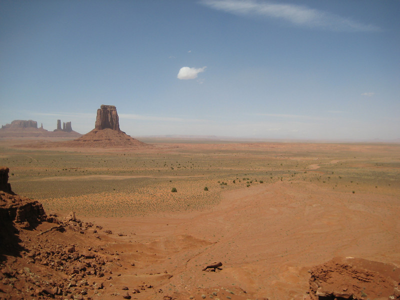
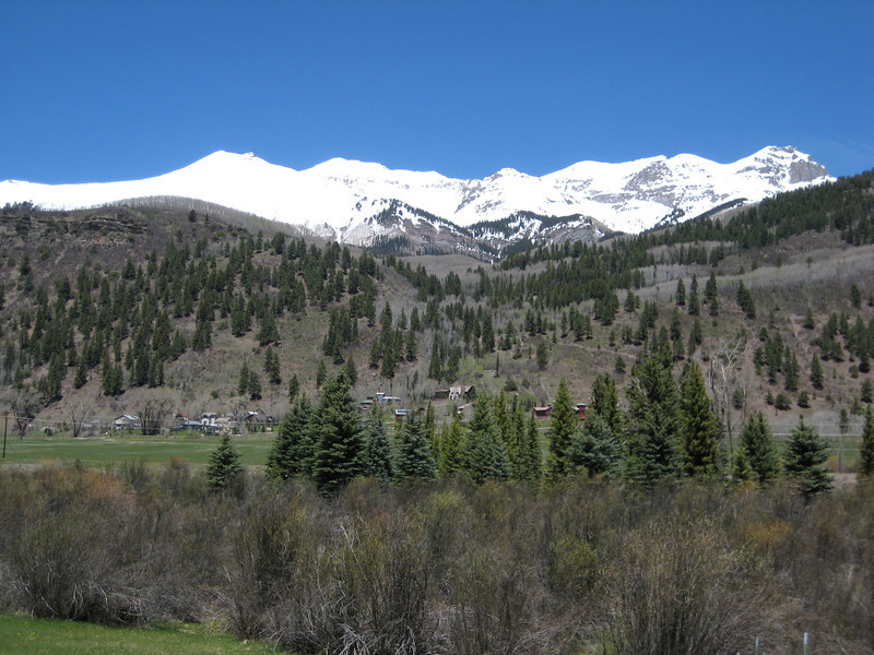
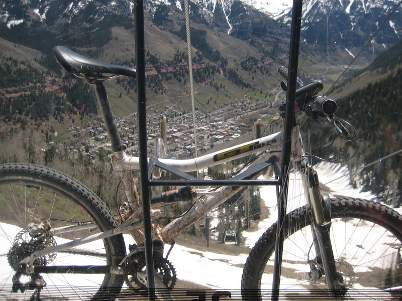
My bike got its first ride on a gondola – been on plenty of chairlifts.  That’s Telluride down there.

Alas, the visitor center was wrong – the bike trails were closed due to too much snow. So we made up for it with a very pleasant ride along the San Miguel River that runs through town. There is a Mountain Film festival on this long weekend, so town had a lot of life to it. We didn’t have long, but I really liked Telluride – looks expensive though, Valerie saw one 5 bedroom, 7 bath house priced at a cool nine million.

The drive back down the valley was just as pretty & I was riding by four o’clock. With four loops to choose from, I went for the longest & hardest option – to make sure I got my money’s (not that I had to pay anything) worth. The riding was mostly at 2300m around a mesa top in more pine forest – it was nice to be riding in trees again. I’m not sure there was anything advanced about this intermediate-advanced level trail & the trail obviously wasn’t as well designed as yesterday’s ride at Phil’s World. Since when is routing the trail down the middle of a creek a valid trailbuilding option? Occasionally there was a little bit of interest, but mostly it was pretty hohum – the surface was often rutted out by bike tires or six-inch deep horse hoof holes. Still, I got a fair bit of climbing in & time on the bike is time on the bike – I may be getting a little fitter as I did the first loop (2-4 hours) in 1.40 then went on to the adjoining beginner loop, hoping for some views of the mountains – but was disappointed. The highlight was the beautiful grassy meadows, different summer flowers, the very loud croaking of frogs & seeing some eagles gliding around – fantastic. After over 100 km of mostly singletrack riding in three days, I might have a day off the bike tomorrow as we go to Four Corners & Monument Valley.