Wet feet as soon as leaving the hut, we were soon pushing and lifting our bikes up a skinny track for a bit of early (well, eight o’clock – early for this trip) hike-a-bike. Andy and I were thoroughly schooled as Rachel went for the full bike carry across her shoulders. But the tussock and trail were not so bad to dissuade me from keeping my wheels on or close to the ground.
 A clear start to the day, but it hadn’t been cold overnight.
 Hut getting smaller; Rachel’s photo.
 Bit of a switchback, waiting patiently for the sun to strike the corrugated iron of the hut. Alas, as slow as progress was hiking up the hill – it wasn’t slow enough.
 After gaining two hundred metres in half an hour, the Cromwell Cardrona Pack Track became old 4WD track and surprisingly rideable.
 Well, there was still the odd steep part. The ridge behind, part of the previous day’s route (left to right).
 We started to get glimpses of snowy peaks in the distance.
Almost two hours and five kilometres, in it was decision time. Do we continue on the direct pack track to Deep Creek on a barely-there trail (bound to be overgrown with tussocks and spaniards) or do the other two sides of a triangle north-east and then south on 4WD track? After much deliberation, we gave the pack track a go. That barely lasted a hundred metres, the going was far too slow and tough. We bailed and headed off on the double track.
This did mean an extra couple of hundred metres of climbing, but it was far more rideable than the pack track!

 Andy in his element setting up for more videoing. Nevis Valley way off south.

 Mt Aspiring making an appearance.
 The climbing pretty much done now, we had quite a descent to look forward to. About 1400 metres, wahoo!
 But first, someone insisted (ahem, me) that we should walk up to the highest point of our trip – Mt Dottrel – as, when would we be back?
 A steady climb to the flat top, the first real bit of downhill we’d done that day behind.
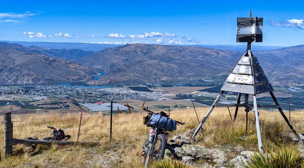
 I think it was worth it. Cromwell down below with Lake Dunstan and the Cairnmuir Mountains behind. Old Man Range on far right, we’d go over that low point between the two later in the day
Back at the bikes, there was nothing for it but the long, surprisingly smooth considering, downhill interspersed with many stops as new angles on the view opened up to stop us in our tracks.
 Mt Dottrel at rear.
 The southern end of the Dunstan Range – must get up there.
 A rut! Quite a surprise. Rachel’s photo.
Lifting our bikes over a locked gate, I was beginning to feel that we weren’t on the farm that we had permission to be on. But what would it matter up here?! We’d eventually get to where we were supposed to be. But with such a warm still day up here – really, not a breath of wind, uncanny – the leaseholders were up maintaining one of their huts. What are the chances?! Apologising profusely for inadvertently trespassing, they were very gracious and up for a bit of a yarn. The beers before noon probably helped us in this situation.
 Even this newspaper clipping was dragged out – not the last time we were told that day of Rambo’s demise. After what I saw over a month prior, he had it coming.
With helpful directions of how to get where we were supposed to be (there was still quite a bit of the wrong farm to get through), we farewelled the farmers and headed off – straight up a pinch climb, only just managing to ride all of that.

 There was much enjoyment to be had on the Pisas picking out places the three of us had ridden together recently. Here the Chain Hills, Dunstan Saddle, the Lauder Conservation Area were visible in front of the St Bathans Range. Still more places to return to or explore for the first time.
 Into the farm we were supposed to be on, finally!
 Occasionally spaniard plants aren’t making me yelp in sudden pain, the spikes seen indicate why they often do.
 Twas a fun and fast descent.
 Rachel’s photo.
 Up the Kawarau Gorge; soon, I’m told, there will be a cycle trail down there to connect to Queenstown. That’ll be cycle trail all the way from Middlemarch! Will just remain to connect it to Dunedin.
 Getting lower. Over to Bannockburn, the start of the Nevis Road, the Old Man and the afternoon’s route over Hawksburn Rd.
 Picking out the sheep tracks that I “ran” up and down on last year’s Mt Difficulty trail half-marathon. What was I thinking?
Down in the valley floor, it was heating up. So we went to the pub.
 You wouldn’t pick it, but this photo is for the slight view of the Pisa Range and where we were just an hour or so before. Quite satisfying sitting eating looking at that, exclaiming “we were up there”! It was fantastic after all.
 Eating, the real reason we go bikepacking. Also notable for Andy’s remarkably clean shirt (Clean Shirt!), bought just for being vaguely presentable in Queenstown. Rachel’s photo.
Having spied family friends drive past us on our brief road section, I insisted we go and visit in Bannockburn. Partly because I’d not caught up in years, partly because it was midway through a northwesterly-fanned scorching afternoon. I think we all enjoyed the visit, fresh summer fruit, and respite from the sun.
Lagging as we again headed out of town, I was taking it easy. It was a blessing when the hot tailwind turned to a cooler headwind, funnily enough. Just twenty kilometres and five hundred metres of climbing before we returned to our start point, I finally seemed to get stronger. Maybe it was just because Hawksburn Rd had always been a bit of a challenge, but after the time over Percy Saddle and then on the Pisas, this was just a small bump in the topography. The elevation graph certainly shows it like that! It must be said that the surface up to and on the pylon road is much improved – far more rideable than I remember.
 Hawksburn Farm in the sun, Old Man Range behind.
 Some of the last climbing for the trip, relatively easy going.
 Undulating across the saddle, there’s the end of the Dunstan Range again. One day…
 Finally, one last, steep downhill back to Mark’s place.
With that, our week-long tour was over. Still can’t believe the weather, never had to put my rain coat on once! In fact, in eleven days bikepacking together on long-planned trips – I wore my raincoat only to drop off the Lauders when it suddenly got cold for a long descent. Considering the terrain we’ve been in, that’s something. And that’s just a bonus on top of the enjoyment these trips exploring lower South Island hills with Andy and Rachel brings – another cracker.
One more plug for a far better summary of what the trip was actually like: Andy’s video.
 Ok, one food picture. Not my usual breakfast while bikepacking, or any time at all. Delicious.
 Certainly was worth waiting for skies like this.
 Over the old Shotover bridge, past a head on the river flats, and looking up to Coronet Peak.
 Back towards Queenstown with a little more elevation.
 I spied a turnout and wanted a better view, letting the others get ahead. Down to Gibbston.
 Strangely empty road, apart from the two bikes that I now had to chase down.
 Rachel’s photo.
 Mt Cardrona, not much of a ski field at this time.
 Spaniards smell remarkably like pine cleaner. Who knew? Well, we did as Andy had been telling of it on the previous trip. Rachel’s photo.
 Things kicked again, but more rideable than I thought.
 Towards Quartz Knoll, the highest point of the day, as we approached Mt Allen.
 Somewhere over there, hidden, is the hut we were looking for.
 The push up to Quartz Knoll, looking back to Mt Allen. Nevis Valley, from the first day of the trip, way off in the background.
 Standing on Quartz Knoll looking southwest-ish to Rock Peak (left, midground). The Airways installation to help passenger jets land at Queenstown visible.
  East to the southern part of the Pisa Range, it would keep until the following day.
 Time for the Type I fun to start – fast, rocky, open descents.
 More climbing, of course, on typical ridge riding.
 Plenty more ridge to go before dropping to Tuohys Gully. The roads to and of Snow Farm and the Southern Hemisphere Proving Grounds (testing of pre-production cars in winter) visible on right.
 There’s a hut down there! Not ours though, although that track at the back is also for the following day’s climb.
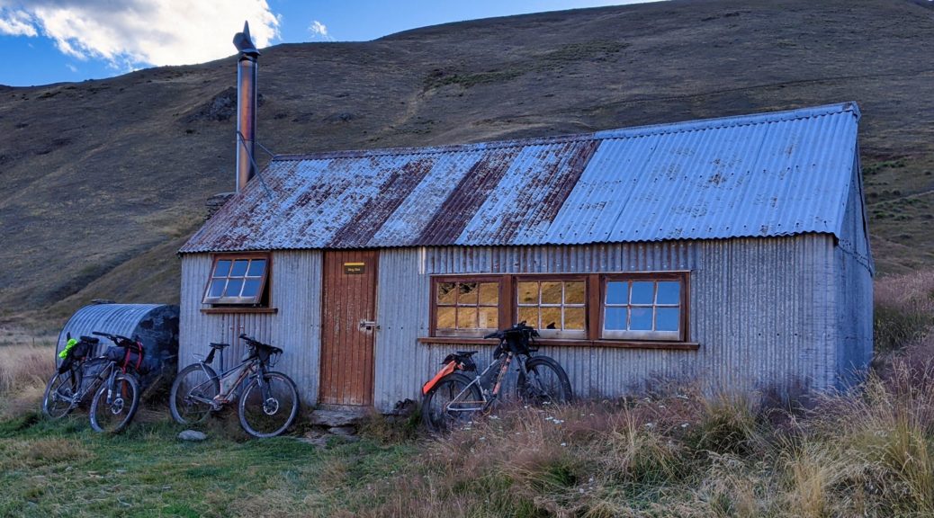
 Aha, there’s our hut! One last fun descent and even a stream crossing.
 Adorable wee hut, and we had it all to ourselves.
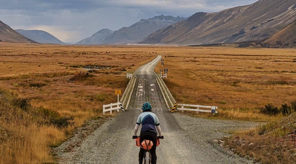
 A little bit of valley to go.
 Easy morning riding, fun times.
 Rachel’s photo.

 Nice to have the time to finally stop and nosey around this old cottage. In remarkably good repair, it looks as though it’s used for occasional dinner functions. Probably in pre-pandemic tourist times.
 Walter Peak towards the right of that ridge.
 We managed to get a late morning tea here while the smells of openly slow-cooked barbecued meat wafted through the restaurant. Pity we’d not booked lunch and a later sailing!

 Mt Titiroa had constantly been around for a couple of days, and still was keeping an eye on us. Top of the steepest climb on this detour.
 The going was easy.
 Inquisitive audience during a snack break.
 Spotting possible shelter to bivy in is a regular aside of bikepacking; I’d give this shed a miss I think.
 Southland scenes.
 Easy climbing, bit more traffic than I expected – but not too dusty.
 Finally I get more than fifty metres down the road to Mavora Lakes, this being about a hundred metres.
 Pretty rare that my tent is up so early on a hot afternoon that it’s worth opening up both sides for any breeze.
 End of the road, although 4WD tracks promise a bit more bike exploration if we should return.
 Another lakeside, another fire.