Our hut-buddy kept Perry Saddle hut insanely warm all night, nice to get up to a not-freezing hut on a grey morning. It looked I might have to don my raincoat for the second day of the trip – but the rain abated just enough to start climbing to the high point of the track without it.
 Easy climbing for twenty-five minutes.
 Time to give the bikes another rest at the summit; usually worth a wander to the lookout.
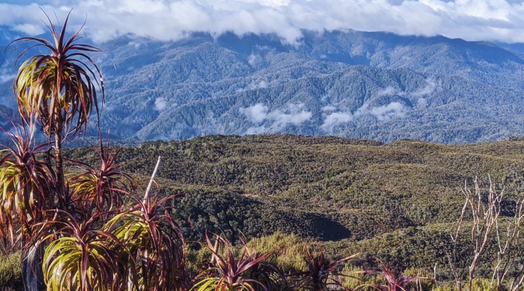
 South over the Flanagan Creek valley.
 East to our first sighting of the Aorere River, which we’d follow all the way to Golden Bay.
There began our ninety minutes and eight hundred metres of descent to the end of the trail. Much fun with occasional stops to look through any break in the bush, chat to the only other trail user we saw (a trail runner out for the day) and clear the odd bit of tree fall.
 A fleeting friendship at Aorere Shelter.

Two hours in and we were marking the end of an excellent, slow trip through the Heaphy with it mostly to ourselves – another memorable ride through, certainly is a special trail and place. Bit of a shock seeing even a little bit of traffic again as we rolled the thirty-five kilometres to Collingwood.
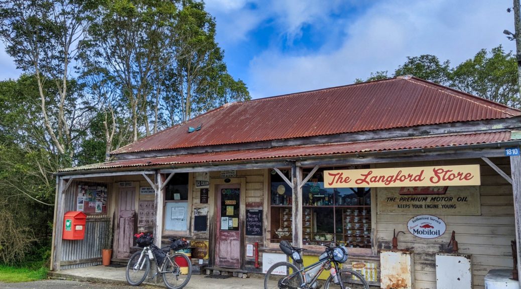
 Brief stop at the Bainham Store, one day I’ll visit when it is open and poke around all the curious things on display inside.


 They seemed to have a complete set.


 Our charmed run with the weather continued as the rain threatened but stayed very much in the hills, as we went back to Rockville.
A big, delicious lunch was savoured at The Courthouse Cafe in Collingwood before we set off for Takaka, which was only half as far as I thought – score! Even better, the norwester was at our back the whole way.
A warm afternoon, well – warm enough for ice cream. We pottered a bit getting a derailleur hanger straightened and working out where to stay that night – we still had a day and a half to complete the last hundred kilometres to Nelson and Pete’s flight home. Jonathan came through for us and we could stay in a hut halfway up the last climb of note of the trip. Time to stock up for another night in the bush; I was most thankful for this as the late-afternoon rush in Takaka was a bit overwhelming and I just wanted to escape again.
 I may have got a bit carried away buying non-freeze-dried ingredients to cook dinner. Somehow everything was squeezed in or strapped on, off we went.
With overloaded bikes, and half a dozen eggs, we opted for the easier and smooth gravel road climb over the singletrack. As it was, it was steep enough! We were pleased to see slips from recent heavy rain had been cleared, as I was happy to clear the climb.
 Made it!
 How good is this?!
I particularly enjoyed all the native birdsong, especially a raucous kea, that goes with all the hard work in planting the hillsides in natives. Cooking far too much carbonara in a large pot on a small stove by torchlight was also fun – plenty left for breakfast and lunch the following day.
The following day, the last of our excellent tour, is without photos as my phone further made its case for replacement. But it was fairly uneventful – I loved the Rameka climb again (we walked and chatted a lot, occasionally I tested myself on some of the technical parts, there was one slip which required a bit of carrying), Canaan Downs is very pleasant, the top half of the huge descent off Takaka Hill (sealed highway) was exhilarating, by the bottom half I was bored and disengaged! From there, I just told myself it was an eighty kilometre commute to Nelson and didn’t expect any more. Unexpectedly, I did get the second-best pie of the trip in Motueka – so that was a high point.
Andrew met us on the outskirts and guided us back to his, ending our ten-day Hokitika to Nelson tour of some of the best multi-day trails to be ridden in NZ. What a trip, so fortunate with the weather enabling Plan A to be realised, and being able to take our time through spectacular country wth few others around. Only some minor mechanicals (mostly flat tyres) slowed us, but not enough to disrupt plans. Thanks Pete for the idea, planning and invite – another trip to remember. Also thanks to Rachel, Nina, Jonathan, Andrew and Diana for the accommodation, food and mechanical support.
 Down to Heaphy mouth.
 The trig on top has certainly seen some weather.
 Over to the Tubman Range; Heaphy River down in between somewhere.
 Can’t stay staring around at the summit all morning, time to head down. Lush.
 Back into the forest for a short while as we climbed towards Tasman district.
 A small drop, with some trail clearing, took us to these flats beside the Saxon River.

 Out into the Gouland Downs section; pleased the rain has stopped, always feels a bit exposed out here.
 Here’s another Big River.
 Down off one side of the trail…
 The caves certainly were not hard to find.
 And none too wet, we could walk underneath the trail with dry feet soon popping out on the other side to clamber back up.
 Beginning to see how the forest got its moniker.
 Follow the water and they’re even easier to find.
 Leaving the Downs, another brief spell of jacket wearing.

 I had good fun clearing as much as possible as the trail got rockier and more difficult to negotiate.
 The briefest of appearances for the afternoon.
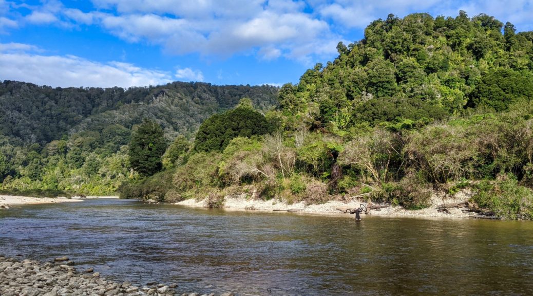
 Heading for Kohaihai – can see the bluff in the distance.
 A short diversion to the lookout – north along the beaches which we’d ride beside for the next two hours.
 Back along Scotts Beach to Kohaihai Bluff.
 Still a few bridges across the bigger creeks pouring straight out of the hills into the sea.
 Nikaus! Tall ones at that.
 A clear section of trail – much of it was littered with big nikau fronds, other tree fall and wash from big, stormy tides.
 What a day, what a place! Again, with the bridge out, we were the only ones going through and pretty much had it to ourselves.
 We did find a few small slips along the coast which required a bit of bike-carrying and -wrestling to clear – nothing too serious.
 Lunch views. Tough day at the office.
 More green beauty.
 Bridge has definitely gone.


 Over the Lewis to the missing hut (such a shame, it was a classic and actually had character – unlike the big new huts on the track) and the strange new shelter perched higher.
 Where has Pete gone?
 Oh, there he is.
 Am I grinning far too much in this situation due to the absurdity of this self-inflicted episode, or due to it being far easier than the
  Through; yes there’s a track either side of – and under – that.
 Through the slip.
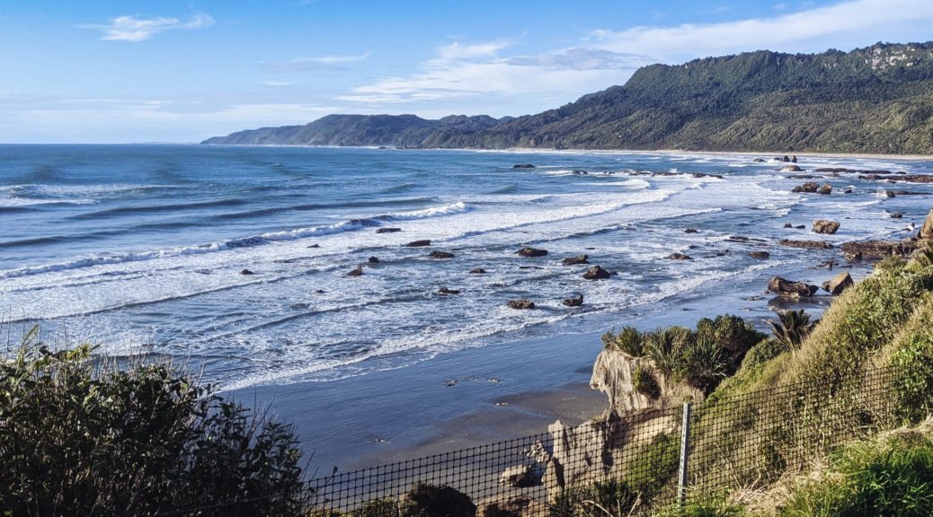
 More nice rocky trail, heading towards Croesus Knob – must wander up there one day.
 Towards Moonlight Tops. Spot the trail, left to right.
 I do enjoy this view, anticipating getting to the escarpment on the right, and then riding very close to the top and edge of it. Not least for the goblin forest that covers this section.
 The mossy trees don’t have quite the same atmosphere when there’s no mist sneaking its tendrils through; but certainly not complaining about such a clear sky!
 Continually distracted studying the old forest.
 Popping out of the forest briefly to see the sea.
 Ooh, the emergency shelter has been upgraded considerably. Digger garage this end, enclosed shelter other end – another good bivy spot.
 With no one else on the trail, I didn’t feel rushed to get off the bridge beneath this waterfall and managed a couple of snaps this time.
 One of the more tightly-switchbacked sections through some enormous boulders.
 It would be a shame not to stop at this thoughtfully provided seat.
 As I was the previous time, I was transfixed by the tight contours of this peak – Lone Hand. The topo map is a mess of packed, twisted lines.
 Such a nice, still afternoon there was no need to have afternoon tea inside the last hut.


 Calm, clear and mild for a late-afternoon ride – Southern Alps off in the distance.
 Heading into Fox River.
 Getting towards the northern end of the Paparoas.