Twenty-three kilometres! Easily my shortest day of bikepacking yet. It was utterly fantastic; such a luxury to take our sweet time through the deserted Heaphy – we saw no-one else on the track all day.
Hand scribbled notes and maps in James Mackay hut told of a short track up the hill behind. On a nice morning, there was no way I wasn’t going up there. Even with a rough track, which was mostly up a rocky, rutted water channel, it was only fifteen minutes to climb the hundred metres to the summit of Otepo.
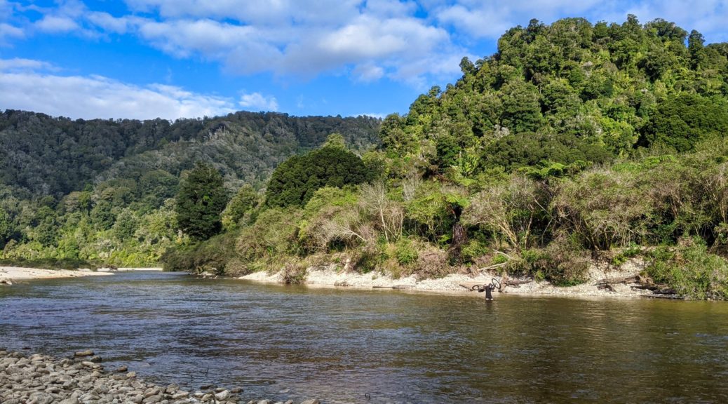
 Down to Heaphy mouth.
 The trig on top has certainly seen some weather.
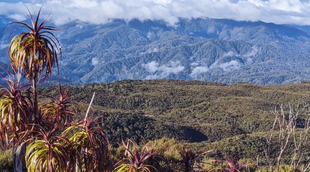
 Over to the Tubman Range; Heaphy River down in between somewhere.
 Can’t stay staring around at the summit all morning, time to head down. Lush.
By the time I returned to finish packing, who knows how many coffees Pete had had – and it had clouded over. Shockingly, I had to put my raincoat on for the first time on the whole trip – seven days on the West Coast! Incredible fortune with the weather late-winter. The drizzle was light and the jacket didn’t last long as it soon ceased.
 Back into the forest for a short while as we climbed towards Tasman district.
 A small drop, with some trail clearing, took us to these flats beside the Saxon River.
I was hopeful of seeing my first takahe some time during this sightseeing day. I was delighted to see this pair as soon as I looked around the corner of Saxon Hut.


It was time for a long lunch in the hut watching their antics; very cool, and at times amusing.
 Out into the Gouland Downs section; pleased the rain has stopped, always feels a bit exposed out here.
 Here’s another Big River.
It didn’t really matter how slow we were going, but progress was reasonable enough as we entered the Enchanted Forest for a short time before popping out to Gouland Downs Hut.

It’s such a charming little hut, we were tempted to call it a day there – but it is very dark inside and the open fire has leant it a decidedly smokey atmosphere inside. But nevermind, caves to be found! On previous rides through I had no idea there were a number of small caves back under the Enchanted Forest – I’d unknowingly ridden over one four times! Leaving our bikes at the hut, we went exploring.
 Down off one side of the trail…
 The caves certainly were not hard to find.
 And none too wet, we could walk underneath the trail with dry feet soon popping out on the other side to clamber back up.

 Beginning to see how the forest got its moniker.
 Follow the water and they’re even easier to find.
Back on the bikes for the last stretch, climbing gently a few hundred metres to Perry Saddle.
 Leaving the Downs, another brief spell of jacket wearing.


 I had good fun clearing as much as possible as the trail got rockier and more difficult to negotiate.
At the hut just after three, that was a most enjoyable short day seeing more than I have on previous faster rides through. We even had plenty of time to properly heat the sprawling hut this time; again, a bunk room each. I found a large book detailing the history of the track and area – fascinated, I read much of it that evening.
 The briefest of appearances for the afternoon.
 Heading for Kohaihai – can see the bluff in the distance.
 A short diversion to the lookout – north along the beaches which we’d ride beside for the next two hours.
 Back along Scotts Beach to Kohaihai Bluff.
 Still a few bridges across the bigger creeks pouring straight out of the hills into the sea.
 Nikaus! Tall ones at that.
 A clear section of trail – much of it was littered with big nikau fronds, other tree fall and wash from big, stormy tides.
 What a day, what a place! Again, with the bridge out, we were the only ones going through and pretty much had it to ourselves.
 We did find a few small slips along the coast which required a bit of bike-carrying and -wrestling to clear – nothing too serious.
 Lunch views. Tough day at the office.
 More green beauty.
 Bridge has definitely gone.


 Over the Lewis to the missing hut (such a shame, it was a classic and actually had character – unlike the big new huts on the track) and the strange new shelter perched higher.
 Where has Pete gone?
 Oh, there he is.
 Am I grinning far too much in this situation due to the absurdity of this self-inflicted episode, or due to it being far easier than the
  Through; yes there’s a track either side of – and under – that.
 Through the slip.
 Soon looking back at the confluence of north and south branches for which the hut is named.
 Still plenty of small stream crossings, most rideable, some prudent to walk.
 Enjoying the reappearance of the rimus – probably my favourite native tree. This section of riding was plain good fun too.
 Not quite the picture I was going for, but at least I didn’t get the one I was after and end up riding one-handed into the creek that suddenly appeared while I was distracted.
 Out before eleven, that was the singletrack riding done for the day and time to complete the pair of obligatory photos.
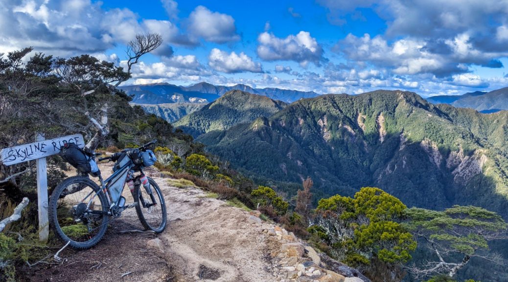

 But first, the obligatory photo.

 Taking the time to poke around a long abandoned hut.

 Occasional view of the upper Mokihinui Valley.
 Hurrah, out of the bush and off the slow surface.
 That’s better, more to see too – not quite as clear as previous day, or rides here, alas.
 Back west to where we were not twenty-four hours before.
 Trying to spot just where we were, cloud not helping.
 Ooh, it’s brighter east. Down to the lower Maruia River.
 Still climbing, just.
 Rocky Tor, which we’d spotted from Denniston Shortcut in clear weather the previous day.
 Switching sides of the ridge for the precipitous traverse to Heaven’s Door and the high point.
 Still mostly rideable, there are small parts it’s prudent to walk (especially with a loaded bike); also, there are far more fences than when I first rode this section in 2015. Pete’s story of a previous companion falling off the side, breaking a wrist and walking out, was reminder enough not to do so.
 The view east from Heaven’s Door.
  Looking back from the bush to the ridge traverse.
 The trail continuing below Ghost Lake Hut.
 Such a great place for a hut.
 The snow we could see from Denniston Shortcut now making an appearance.
 Out of the switchbacks and looking back to the hut.
 Down to the Stern Valley, we had six hundred metres to drop in not long. We’d ride along the valley floor, before climbing right through the Boneyard under that mass of rocks that looks ready to let go at any moment and then exiting through the bush at the saddle on left of the centre ridge.
 But first we had a ridge to ride along, and then down – more walking here as the track deteriorated again, steep, tight and rutted out.
  Bit of a carry down scores of steep steps.
 Ooh, trail building – perhaps a way around the Skyline Steps, and ridge (?), has been found…
 Climbing through the Boneyard is far more pleasant without direct sunlight!
 End of the climb through the rocks, back towards Stern Valley from the north end.
 Nice to be back in the bush.
 A short detour to spot Goat Creek Hut, but we didn’t fancy fording the creek and getting wet feet just to get closer.