Category Archives: bikepacking

Heaphy Day

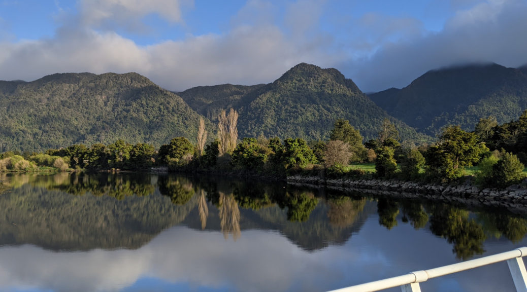
Twas worth waiting for the weather, leaving the campground in the dark a cracker of a day dawned. Using the Heaphy Track as my gateway to the West Coast, I hoped to ride to and through it in the day. First there was fifty-odd kilometres of gentle road riding, but the big question was how much snow would be on the track? With a biking curfew during darkness (due to giant land snails, I kid you not), would I get off the track in time or be forced to overnight in a hut or campground? With form of riding the whole trail there and back in two short days around winter solstice, I figured I could easily start at nine in the morning and ride through in daylight – if the snow was kind.

The highway riding was peaceful and a gentle start to the day. Delayed as I couldn’t go past someone parked on a sketchy shoulder struggling to change a car tyre, I started to slip behind the vague schedule. But it was so lovely riding, there were no worries there.

Turning inland, I retraced my path back from the third corner trying to gauge just how much snow remained below 900 m. It was far more pleasant than the driving rain of three days before.

I took the gravel option over Mackay Pass that I’d skipped on the weekend (knowing I would come back for it) – it was worth the little extra climbing. Of course I had time to dive off route and check out a historic bridge and some falls – when was I going to be back?

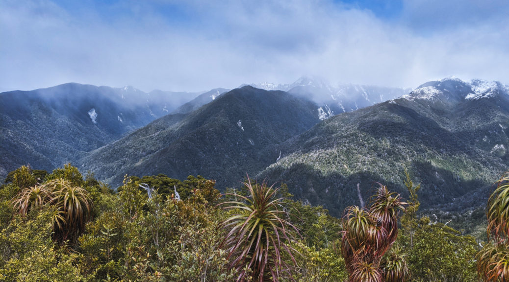
I shouldn’t have been surprised to see another bikepacker approach as I neared Brown Hut and the start of the track. Into the only real climb of the day, I soon passed another bikepacker going my way – on a tour the length of the country, he was far more laden than most but having just as grand a time. Occasional glimpses through the dense bush afforded views of near hills lightly dusted with snow. At about 500 m snow started appearing trailside and as it gradually built, it was still easily rideable – until 800 m and then it just became easier to walk. Firm and dry it was really easy pushing over the snow, and on such a brilliant day it was no hardship.

A short walk for another view.

I already miss being able to fill bottles from the multitudes of clean West Coast streams.

Reaching the high point took two and a half hours; with gravity to assist, the run down to Perry Saddle hut was easily rideable. Following lunch in snowy solitude, the descent towards Gouland Downs was fun in the snow. More exposed to the sun here, it certainly was a soaking section. More engaging riding followed, especially the drop towards Gouland Hut, where I eventually caught up to a few groups of hikers soaking up the sun over lunch. More friendly chat before I pressed on.

Saxon Hut and more hikers to chat to, including one with a thirty-plus year old macpac pack – classic. Great to see so many families out in the school holidays enjoying the national park. Twists and turns and a smaller climb took me to James MacKay hut; even more pleasing to see a whole family out bikepacking. Oh my, the descent to Lewis Hut.. Three-quarters of an hour of twisting and turning losing altitude the whole time (save any stream crossings), the track is much improved from the big upgrade that was in progress five years ago. I clawed back some distance in short time with the big drop to sea level, various averages playing through my head – I was still confident I’d beat the curfew.

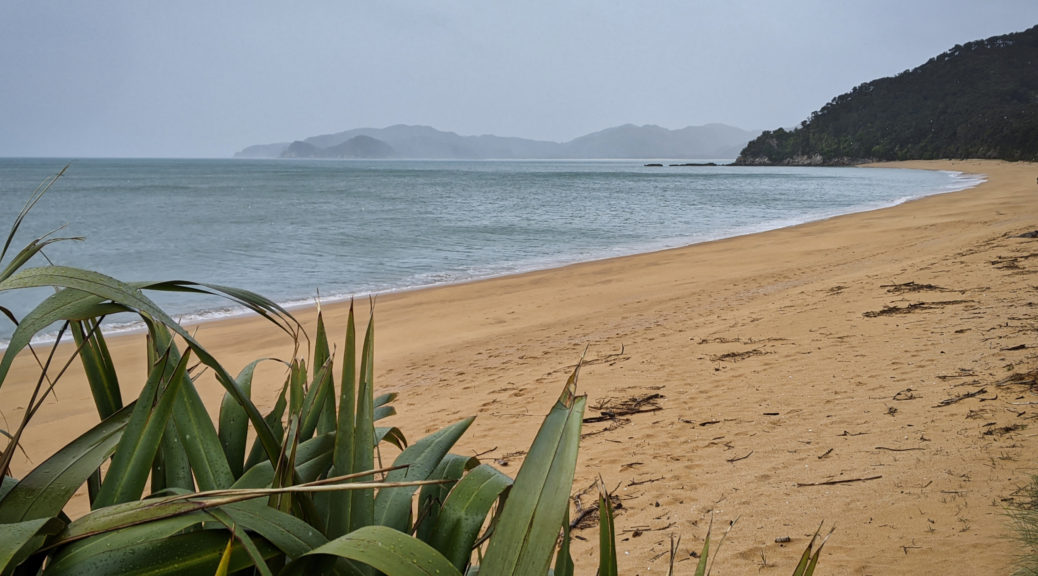
Into the coastal section, the change from snowy bush to riding through a sub-tropical rainforest was complete. Sea level it may have been, but it certainly was lumpy as the trail kept climbing around small bluffs and heading inland and up to cross raging streams. Getting to the end of a long day, all those little pinches were doing a number on me. But, the views!

One last hundred metre climb and down to the trailhead it was – leaving these views behind.

Beating darkness by almost two hours meant the pub was still pretty full and the kitchen open when I arrived an hour later. Well fed, I set off into the gathering dark to be warmly welcomed by Mark and Jenny – good friends of my sister. Running out of superlatives for the day, saying I thoroughly enjoyed the ride, the scenery and the challenge of it will have to suffice. It would have been nice to have had more time to explore further and more slowly, but a lot of the slack in my two weeks had been eaten up. Never mind, more reasons to return sooner.
Mostly Sitting Out The Storm

The storm only intensified overnight, I woke often to hear rain lashing and wind buffeting my little cabin. Climbing a thousand metres above sea level in such weather didn’t promise many new sights, so I rolled over and dozed throughout the morning. With a break in the torrential rain, I dragged myself out and allowed the wind to push me around to Pohara – where I promptly stopped at the first cafe I found.

There was another likely-Six Corners bike in the rack, so I went to find the rider. We were soon joined by two more and a large and long lunch commenced. Tales of much bigger and stronger riders being buffeted and blown off their bikes were enough to have me reaching for another cup of tea. It’s always good to hear others’ bikepacking stories and pick up little tips; at the start of a two week tour, I took the advice to ride just a little further around the coast.

It looks nice, shortly after I was blown across a lane of traffic battling through a wind-funnel of a cutting.

Down to Ligar Bay from Abel Tasman monument.

I battled back to my little cabin and pored over forecasts as I was planning to ride the Heaphy Track to the West Coast the next day. It was fifty-fifty, and it didn’t look like the snow would get down much below the highest point (900+ m) – still “blizzard conditions with gale westerly on the tops”. So I prepared to leave the following morning, when hopefully the wind wouldn’t quite be gale force.

Waking early, the forecast had deteriorated further and the snow was due much lower. As the day dawned, I could see snow on the hills behind Takaka (basically coastal) down to 300 m. The wind continued to howl, so it seemed prudent to wait it out. I went for breakfast downtown, checking out of my airbnb and finding another cabin at the campground – cooking facilities would give me something to do and remove the need to eat out for every meal.

Heavy rain blew through and I couldn’t just sit around for two days. When the sun appeared I set off for another corner – Totaranui. I’d continue past the monument and a couple more bays before climbing a few hundred metres into Abel Tasman National Park and dropping to Totaranui on the other side.

Wainui Inlet

The wind pushed me gently east, and it only started to rain after finding the gravel and starting the climb. A convoy passed me, many teenagers and their instructors heading to start hiking the Abel Tasman Walkway. A soaking descent to sea level, I looked around briefly, had the wind blow my parked bike over (cracking the visor on my helmet), and chatted to some hikers before turning back.

Without it, I quickly found just how much I use the visor on my helmet to keep driving rain out of my face – a lot, that is. The wind was picking up almightily by this stage. Back down to sea level, I turned briefly south and was fair blown towards the Wainui Valley. That didn’t bode well as I cut west, crossed the river and turned north to head up the other side of the inlet. Progress was slow.

Suddenly I was blown fair across both lanes of the road and narrowly avoided being thrown into a fence. Rather startled, it was time to again start pushing my bike along a flat road. Rain continuing to drive into me, at least it wasn’t quite cold. The twenty kilometres left may take some time. When a couple pulled up beside me and offered a lift, I had no hesitation in accepting – no point in putting myself at risk of being blown into traffic. I lived to ride another day, or as it was the following day – sit it out and watch the snow come down the hills behind town and retreat whenever the sun returned. I was itching to get moving again, thankfully the next day looked a pearler so I prepared for a big day on the Heaphy.

Six Corners Challenge – The Western Half

The framework of the Six Corners Challenge is different to any other bikepacking event I’ve ever done and is what finally drew me to the north west and upper west of the South Island on my bike. Instead of following a set route as quickly as one could, riders were to visit the so-called Six Corners of Golden Bay in any order they chose over the thirty-six hours of the weekend – as quickly as they could. The west is very flat, while the east is very hilly. I planned to ride the hills on the Saturday and explore the west on Sunday.

Weather was in the headlines beforehand with the claim of a soon approaching storm with the biggest measured pressure differential between the north and the south of our small country. Clearly that meant wind, and a lot of it – I revised my ideas and decided to head to the exposed western part of the course first.

Arriving at quarter to six, I was starting to get concerned I’d not correctly found the village square.

Gradually other riders congregated, all new faces to me, some with familiar names. I lost count at about twenty, I think there were twenty-five – the largest turn-out yet, despite the deteriorating forecast. After a quick briefing we were off, the field splitting east and west.

A lot of seal first, the riding was easy as the sun rose. With little traffic it was pleasant enough to chat away as people came and went. A few were from Wellington, but most the upper South Island – I think I’d travelled the furthest. Having ditched half of my touring kit, I quickly found I was both over-biked for the easy terrain and carrying a little too much. Oh well, the weather was likely to turn and I still had two weeks of touring on this bike when it would not be enough of a mountain bike; a good compromise though, I thought – even if a gravel bike looked ideal for the Six Corners course.

Past Collingwood, I was tiring of the flat seal – why weren’t we going up that bulldozer track?

Certainly wasn’t any wind about yet!

I lagged behind a little, heading to Cape Farewell seemed logical to me – something about getting the top of the South Island for my first corner.

Huzzah, some gravel and a little climbing.

As I neared the end of the road, there weren’t many people coming back – most had chosen instead to turn west and head down the coast first.

Surprisingly still here, I enjoyed the ride back chatting to a local about his experiences televising big international cricket matches.

Turning west I lost my riding buddy as he went to Brown Hut; over a small hill the road turned to gravel and skirted around the surprisingly large Whanganui Inlet on a series of seventeen causeways. The clouds were scurrying through and rain threatened for some time.

Stopping here was a cue for the heavens to open for ten minutes.

By the time I got up here, the rain gear had to go.

The Tasman Sea is just behind those hills, as my route continued left.

Bridging from the inlet to the coast past farmland (I guess the only reason the road is there?), riders returning from the Anatori River corner began to appear. The ten kilometre section to the river paralleling the coast had more than enough little pinch climbs to keep the legs honest.

That’s Corner Two, just out of shot a rather makeshift campground filled with hunting, fishing and whitebaiting types.

Retracing my tyre tracks was not as unpleasant as it might have been – it gave an opportunity to see somewhere I’d, until very recently, never been from a different angle.

A most excellent late-lunch and large pot of tea at the Old School set me up to ride south to Brown Hut, at the northern end of the Heaphy Track. It was still incredibly windless and the riding was still easy going – I was enjoying looking around, even if by then I’d lost all company.

This place wasn’t open late on a Saturday afternoon, more’s the pity.
Hitting the gravel for the last stretch to the hut, a short flurry of riders appeared – I was only ninety-odd minutes behind. What had I been doing all day? Slow because I’m looking around too much or looking around so much because I’m slow? Whatever, it had been a good day out and I was pleased to take the required photo at another corner.

The last day of standard time for the year, the sky simultaneously darkened with the sun setting (not that I could see it) and the clouds thickening. With forty easy kilometres to go back to Takaka, the rain started. Before long I was in all my rain gear and the heavens opened. Fortunately it was not cold or too windy, as it was a downpour all the way back. Any downhills had to be taken carefully lest the rain strip some skin off my face; the few vehicles there were gave me a wide berth, either out of pity or trying to avoid the crazy person on a bike.

Back in town to find all the kitchens shut, I was a walking puddle attempting to find some food. A large bowl of shoestring fries failed to appease my hunger, but the cup of tea was most welcome. With the storm having now arrived, I wasn’t going to see much so returned to my cabin, opted for a warm shower and snuggled into bed. It had been a while since I’d ridden so far, I was pleased to have seen many new places, that the weather was mostly good and I still had legs to keep riding. A long, flat and mostly sealed ride not exactly my forte or favourite, but hey ho – plenty more to come on this trip. The other corners could wait, it helped that I’d already seen one of them on my ride over Takaka Hill the previous day.

Getting to Takaka

To my surprise, my bike was assembled from its travel bag and I was ready to leave Nelson by half-eight Friday morning. I was well excited to be going on my first solo tour of more than a few days for over six years. A small bikepacking event over the weekend was drawing me finally to Golden Bay, and after that I was looking forward to a couple of weeks on the West Coast riding some of the long backcountry trails that the area is blessed with.

First, to Takaka; with a whole day, biking there was the logical choice – even with Takaka Hill in the way. Much easier than organising a bus anyway. Flat cycle trail took me out of town, skirting the estuary and past a large sawmill. I missed the reopening of the Mapua ferry by a day, so was left to find the quietest route west on the fly. The backroad to Motueka wasn’t that desolate, but it wasn’t a highway.

After a few spits of rain, the day cleared nicely.

Hitting Motueka for an early lunch, I made sure to fuel up for the 900 metre climb. I didn’t get far into it and found a complimentary/compulsory shuttle through a lot of roadworks, so that cut out a couple of hundred metres of climbing – which I was both pleased and disappointed by.

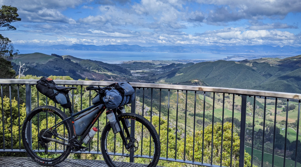
Almost at the top of the road, a short side trip for the view.

Yup, the hills certainly climb away from the coast very quickly.

Near the summit of the main road, I turned off north and continued to climb before eventually dropping to Canaan Downs. So many rocks everywhere in the paddocks, and a little native bush to ride through. It looked a sweet place to camp as the downs opened up, and I found a cheeky bit of singletrack to ride, confusing the sheep and avoiding orienteer scouts, before the Rameka Track started.

A very old track, as far as NZ European history goes, that’s been revitalised – it was great to work my way down to sea level. A loaded rigid bikepacking bike may not the best stead for it, but I was thrilled with the descent through the bush. Occasionally the views opened up, but I was having too much fun to stop much.

Before long I’d lost all the altitude and was rolling into my Airbnb on the outskirts of town; a top day getting to Takaka and moving the legs a little before the weekend’s challenge.