With just one more section of the route I had in my head left to confirm, it was an early Saturday start to drive south.
 I was early so popped down to Kairakau Beach to check out the camping facilities – but mostly just looked at the view.
Meeting Richard and Ange, the farmers who are being kind enough to not only let me route through the station but suggested a far better track to follow, we soon sat down to discuss how these sorts of bikepacking group rides work. Working out what was reasonable conditions to let an untold number of bikepackers loose across the farm was fairly straightforward and we had a good understanding.
Richard was tried to describe the route I should follow using a map; visualising it became a whole lot easier when he pulled out a drone and sent that off into the sky above and around the hills. What a fantastic tool, it made route-finding on the ground a cinch. After checking out the shearers’ quarters generously offered for riders to stay in (hot showers, bunk rooms, kitchen, BBQ, WiFi – luxury! definitely better than sleeping in a ditch), I was off riding.
I was soon reminded of the peanut butter mud-fest that struck us the last time I’d been in the area. Just the slightest moisture overnight on the exposed dirt turned an innocent looking surface into a wheel-binding paste. Not even twenty metres in, I couldn’t ride and was off pushing. I don’t believe it! Again?! This stuff sticks to everything. Thankfully, after scooping the excess off and only a little bit of walking, enough grass appeared beside the track that wheels would turn without accumulating more mud. I could ride, however slowly. Situation much improved, I got right into the ten percent climb. The sheep and lambs were vocal as I interrupted Saturday morning brunch.
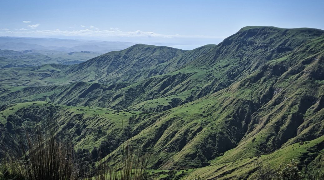
 Climbing so, the views quickly opened up as I looked south.
Half an hour of ascent, and many gates, later I was not lost and set off along the ridge. The cattle were even more perturbed by this strange apparition, but took it well – naturally becoming curious as I rode on. Talking to them may have helped.
 Bare Island came into view; but more importantly, one could see the finish way off on the horizon. It’s only another 400 kilometres of riding away, and just a few hills.
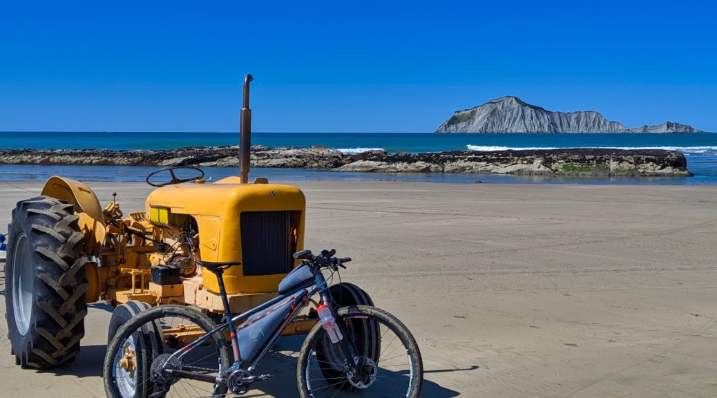
The descent was fast enough for me on rugged farm tracks, with hard tyres and no suspension. Obstacles, holes and livestock were easily avoided. Off the farm, it was a short cruise down to Waimarama for lunch. I figured it was such a nice day and I had the time – a beach visit was in order. Pleasingly, there was quite a line up of old tractors, hitched to boat trailers, patiently waiting the return of fishers.

 Making a break from these scouting trips.
 Another horrible day out exploring Hawke’s Bay.
Time for more roads new to me, I left town up Okaihu Rd; and I do mean up, straight into another ten percent pitch. Cabbage Tree Flat didn’t have many such trees to speak of, but it was refreshingly flat(ter) and lovely gravel. Topping out after four hundred metres of climbing, I enjoyed the long shallow descent down past Maraetotara. The views of Kahuranaki were constantly catching my attention, and it was odd to see Te Mata from a distance south. I realised it was actually quite windy, somehow I was sheltered earlier from the westerly despite riding along a ridge top.
Turning at the end of the road to retrace my steps, I snacked and only then realised I’d been in the sun for a few hours and sunburn was a possibility. Funny how one forgets about that, it’s not like winter was particularly harsh or bleak. Even before the end of September I was riding in fewer clothes than I do most summer; but that was only because I’d lost my Buff at the start of winter – which I replaced the following day as something to stop sweat dripping in my eyes is again necessary.
 Stopping to distract the livestock from the view on my return to Waimarama.
 Shortly after this old shearing shed, I was back on the farm.
Going north to south was the more difficult of my two trips across Te Apiti. The climb, while not quite as steep, seemed to drag a little compared to the morning’s – tired perhaps. I took the shorter of the two options down to the car.
 It did afford this view – I’m sure I saw more cabbage trees up here than on Cabbage Tree Flat.
That route down was steep and, my, it was rocky and loose. I let a little too much air out of my front tyre, but it did soften things a bit; still, my lower back hurt from the shake down the hill. Turning to look back up, I was certain no one would thank me for routing up what would surely be a needless hike-a-bike. Having said that, with a loaded bike the longer path up may involve quite some walking.
Another fantastic day out riding new places and now I just have to sit down and sort all the administrative details of HBAT.


 Heading out to the first possible connector – the one that had the potential to avoid the most highway.
 Nor were there any obvious tracks either side.


 The Waikare River, just before I got back to Putorino.
 I was heading down and over the right end of this ridge, and eventually turning north and heading towards that glimpse of ocean.
 Up on the ridge, looking back to the high point from which I rode.


 That was a good fun drop down closer to sea level.


 Decidedly unshabby resting spot.
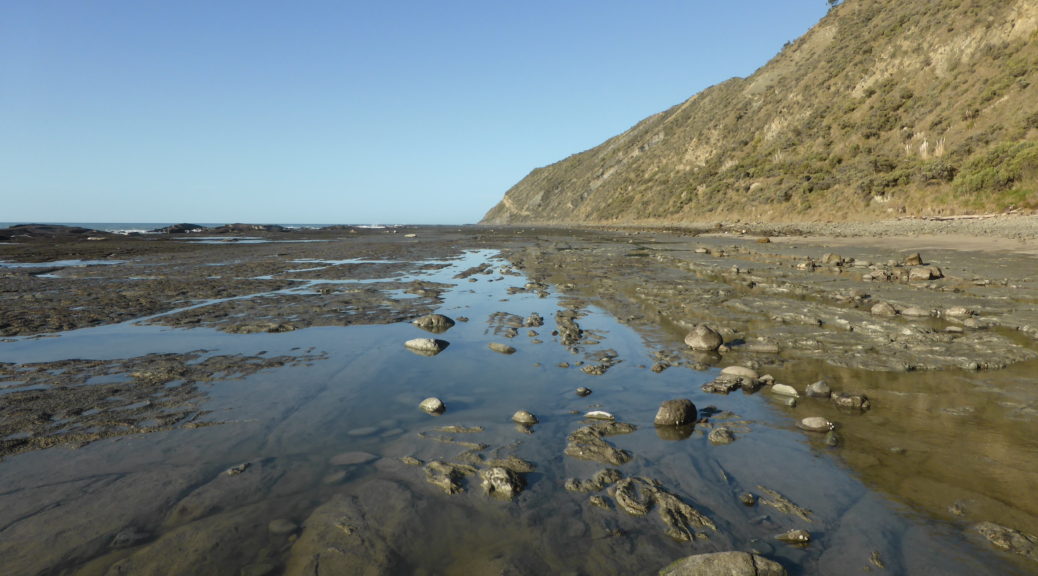
 Tide was assuredly out, this boded well.
 By nine o’clock it was well too hot for gloves and a helmet. What is this winter madness?
 Halfway along this stretch, I decided no one would thank me for this rough going – and I was well aware there may be no other way out. So with the tide advancing, I retreated to the road up onto the main road along the ridge.
 Briefly the actual road diverted from the paper road, I managed to get across this stretch of private land without reaching for some koha.
 Have I mentioned I quite liked the ridge riding – Pacific on one side, Hawke Bay on the other?
 Portland Island.
 Looking down to Rocket Lab’s launch site.
 A brief visit to the beach of Mahia Beach as Saturday dawned.
 The sixteen kilometres back to the highway had a little climbing in it. Wairoa is further west, around the coast some more.
 Wairoa River.
 Finally I learned why there is a lighthouse inland – it was originally on Portland Island (the island off the end of the peninsula), and moved to and restored in Wairoa after it was decommissioned.
 I never worked out where these two were walking to – it was ages to anywhere.


 There’s the road down there, I’m about halfway up by this stage. I see now that the end of Mangaone Rd gets pretty close to where I was but two hours before.
 The terrain flattened a bit and I found myself running across paddocks, somewhat excited to be discovering something that previously wasn’t on my radar at all. Although, it is possible my legs were so relieved to not be pushing pedals around that they couldn’t help but run. Perhaps I really was missing Park Run that Saturday?
 Suddenly, a gate into a patch of bush materialised.
 I soon found myself in a narrow long cave looking up at the stalactites. A cool little find, although I probably won’t send the route up all the way up here.
  Pinning it back downhill, I did manage to pause briefly and spy Mahia Beach and the Peninsula behind it.
