Away before seven o’clock, it was our earliest start yet. Knowing that the day was due to climb over 40ºC is a reasonable motivator for not faffing around. Only a mile from the campground we left the road running alongside the Pend Oreille, beginning a long gradual climb (it averaged out at one percent) up a wide valley floor. The gravel began soon as the day quickly warmed.
 The post-dawn light was rather lovely, and in parts the trees gave way to a bit of grassland.
The lots of private property gradually thinned – not that they had led to any traffic, the place was wonderfully deserted. A few stagnant lakes came and went as we meandered by. Suddenly, our first bear sighting of the trip! Some hundred or so metres ahead it ambled across the road and disappeared into the forest. Giving it plenty of time to clear off, we stopped and admired the beauty around – and probably ate too, we were bikepacking after all.
 The gravel became an unmaintained track – the best type, with grass growing down the centre. If it were possible, things became even more sparsely populated.
It was nice to have the trees crowding in and shading us; we were pretty sure the track would go through as indicated on the GPS… Things rapidly heating up over the next hour, we happened across a big patch of wild raspberries – definitely worth stopping for some relief from the heat shortly before hitting a sealed road.
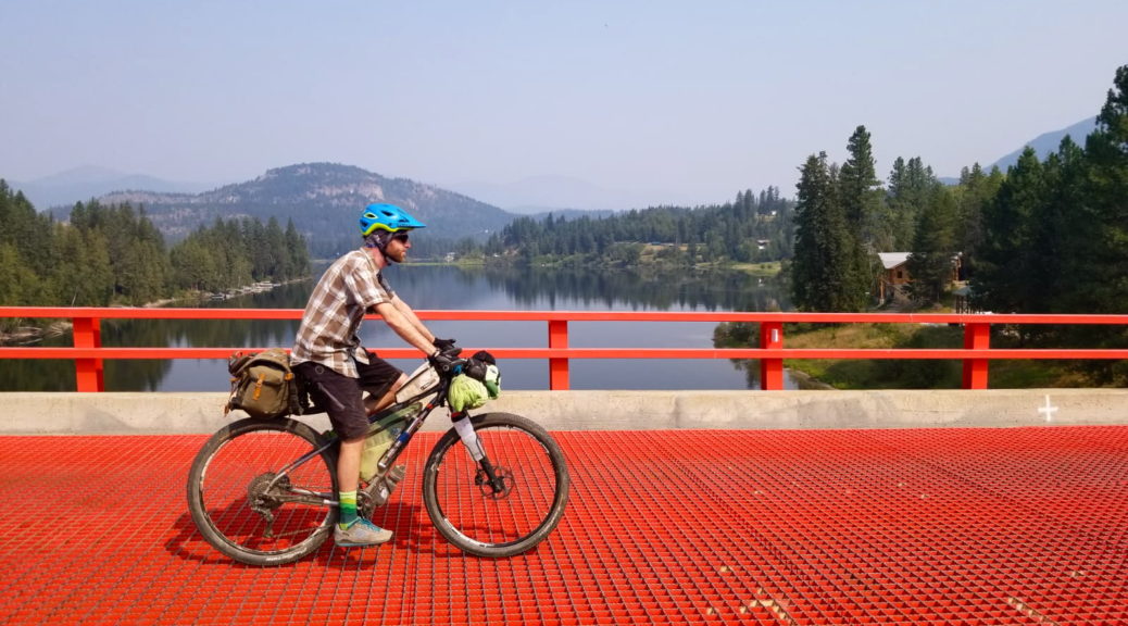
Joining Sullivan Lake Road, we could have headed up to the lake easily. The only snag in that plan is that I wouldn’t have survived well on the food we had. Quickly losing the altitude we’d gained, we were soon crossing the river to reach the small town of Ione.
 There was at least a fantastic red, grated bridge to cross. Looking down through the steel deck, which was mostly empty space, to the river far below was rather unnerving.
Resupply in a dated supermarket was sufficient, if not mostly forgettable. We did at least get to cross the river again.


Of course, we could have taken the direct road to the lake and climbed less than two hundred metres. But why do that when you can head deep into a national forest, try to navigate on roads that are nowhere near those marked on the GPS and climb an extra four hundred metres? It was going to be cooler at 1200 metres anyway, why wouldn’t we sweat all the way up there to find out?
 Also, we hadn’t had our fill of tree-sighting for the day.
A good two and a half hours took us from the river to the summit with plenty of stops for rest and refilling. It was grand, a wonderful climb and so much the better for being on gravel with no traffic.
 With all that effort, we did get to bomb down through four hundred metres of descent in half an hour. Brilliant.
Fortunately a youth group had checked out early – otherwise the two large campgrounds at the head of the lake would have been completely booked out. After thoroughly checking all the sites and finding few available, and resting in the shade, we set up camp and continued resting in the shade and in the cool of the lake.

While our shortest day of the trip after leaving Whitefish, the 41ºC really sucked a lot of energy and the afternoon off recovering was much needed.
 The two campgrounds were only two because there was an airstrip bisecting them.
 And the planes had tents next to them, it was completely adorable.
