Category Archives: bikepacking

Six Corners Challenge – The Western Half

The framework of the Six Corners Challenge is different to any other bikepacking event I’ve ever done and is what finally drew me to the north west and upper west of the South Island on my bike. Instead of following a set route as quickly as one could, riders were to visit the so-called Six Corners of Golden Bay in any order they chose over the thirty-six hours of the weekend – as quickly as they could. The west is very flat, while the east is very hilly. I planned to ride the hills on the Saturday and explore the west on Sunday.

Weather was in the headlines beforehand with the claim of a soon approaching storm with the biggest measured pressure differential between the north and the south of our small country. Clearly that meant wind, and a lot of it – I revised my ideas and decided to head to the exposed western part of the course first.

Arriving at quarter to six, I was starting to get concerned I’d not correctly found the village square.

Gradually other riders congregated, all new faces to me, some with familiar names. I lost count at about twenty, I think there were twenty-five – the largest turn-out yet, despite the deteriorating forecast. After a quick briefing we were off, the field splitting east and west.

A lot of seal first, the riding was easy as the sun rose. With little traffic it was pleasant enough to chat away as people came and went. A few were from Wellington, but most the upper South Island – I think I’d travelled the furthest. Having ditched half of my touring kit, I quickly found I was both over-biked for the easy terrain and carrying a little too much. Oh well, the weather was likely to turn and I still had two weeks of touring on this bike when it would not be enough of a mountain bike; a good compromise though, I thought – even if a gravel bike looked ideal for the Six Corners course.

Past Collingwood, I was tiring of the flat seal – why weren’t we going up that bulldozer track?

Certainly wasn’t any wind about yet!

I lagged behind a little, heading to Cape Farewell seemed logical to me – something about getting the top of the South Island for my first corner.

Huzzah, some gravel and a little climbing.

As I neared the end of the road, there weren’t many people coming back – most had chosen instead to turn west and head down the coast first.

Surprisingly still here, I enjoyed the ride back chatting to a local about his experiences televising big international cricket matches.

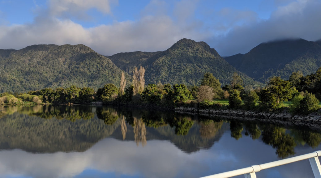
Turning west I lost my riding buddy as he went to Brown Hut; over a small hill the road turned to gravel and skirted around the surprisingly large Whanganui Inlet on a series of seventeen causeways. The clouds were scurrying through and rain threatened for some time.

Stopping here was a cue for the heavens to open for ten minutes.

By the time I got up here, the rain gear had to go.

The Tasman Sea is just behind those hills, as my route continued left.

Bridging from the inlet to the coast past farmland (I guess the only reason the road is there?), riders returning from the Anatori River corner began to appear. The ten kilometre section to the river paralleling the coast had more than enough little pinch climbs to keep the legs honest.

That’s Corner Two, just out of shot a rather makeshift campground filled with hunting, fishing and whitebaiting types.

Retracing my tyre tracks was not as unpleasant as it might have been – it gave an opportunity to see somewhere I’d, until very recently, never been from a different angle.

A most excellent late-lunch and large pot of tea at the Old School set me up to ride south to Brown Hut, at the northern end of the Heaphy Track. It was still incredibly windless and the riding was still easy going – I was enjoying looking around, even if by then I’d lost all company.

This place wasn’t open late on a Saturday afternoon, more’s the pity.

Hitting the gravel for the last stretch to the hut, a short flurry of riders appeared – I was only ninety-odd minutes behind. What had I been doing all day? Slow because I’m looking around too much or looking around so much because I’m slow? Whatever, it had been a good day out and I was pleased to take the required photo at another corner.

The last day of standard time for the year, the sky simultaneously darkened with the sun setting (not that I could see it) and the clouds thickening. With forty easy kilometres to go back to Takaka, the rain started. Before long I was in all my rain gear and the heavens opened. Fortunately it was not cold or too windy, as it was a downpour all the way back. Any downhills had to be taken carefully lest the rain strip some skin off my face; the few vehicles there were gave me a wide berth, either out of pity or trying to avoid the crazy person on a bike.

Back in town to find all the kitchens shut, I was a walking puddle attempting to find some food. A large bowl of shoestring fries failed to appease my hunger, but the cup of tea was most welcome. With the storm having now arrived, I wasn’t going to see much so returned to my cabin, opted for a warm shower and snuggled into bed. It had been a while since I’d ridden so far, I was pleased to have seen many new places, that the weather was mostly good and I still had legs to keep riding. A long, flat and mostly sealed ride not exactly my forte or favourite, but hey ho – plenty more to come on this trip. The other corners could wait, it helped that I’d already seen one of them on my ride over Takaka Hill the previous day.
Getting to Takaka

To my surprise, my bike was assembled from its travel bag and I was ready to leave Nelson by half-eight Friday morning. I was well excited to be going on my first solo tour of more than a few days for over six years. A small bikepacking event over the weekend was drawing me finally to Golden Bay, and after that I was looking forward to a couple of weeks on the West Coast riding some of the long backcountry trails that the area is blessed with.

First, to Takaka; with a whole day, biking there was the logical choice – even with Takaka Hill in the way. Much easier than organising a bus anyway. Flat cycle trail took me out of town, skirting the estuary and past a large sawmill. I missed the reopening of the Mapua ferry by a day, so was left to find the quietest route west on the fly. The backroad to Motueka wasn’t that desolate, but it wasn’t a highway.

After a few spits of rain, the day cleared nicely.

Hitting Motueka for an early lunch, I made sure to fuel up for the 900 metre climb. I didn’t get far into it and found a complimentary/compulsory shuttle through a lot of roadworks, so that cut out a couple of hundred metres of climbing – which I was both pleased and disappointed by.

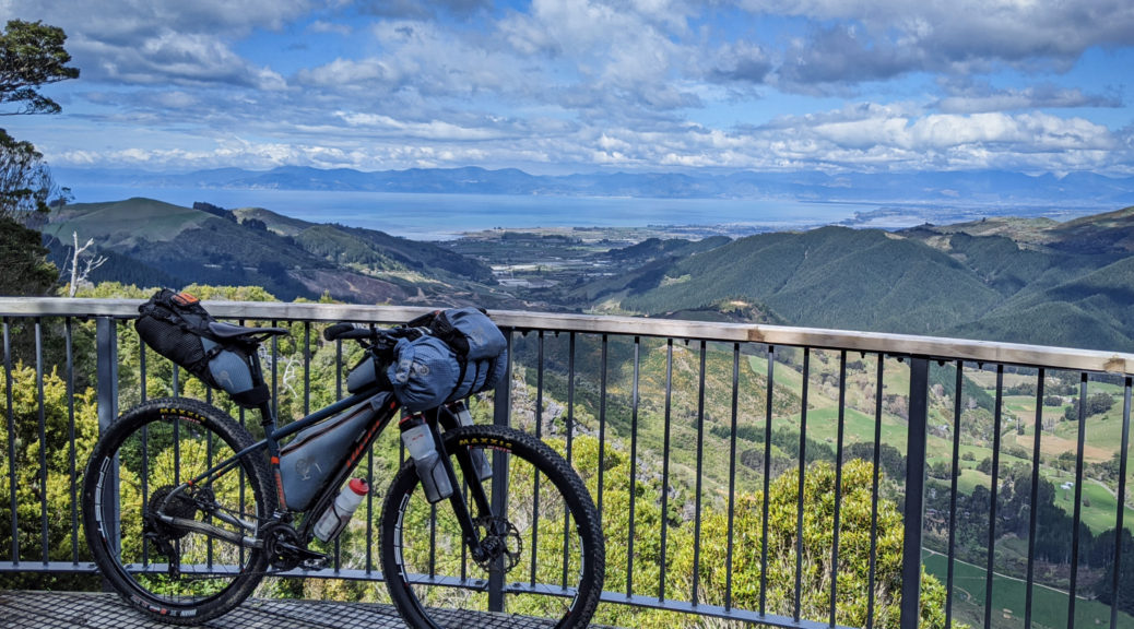
Almost at the top of the road, a short side trip for the view.

Yup, the hills certainly climb away from the coast very quickly.
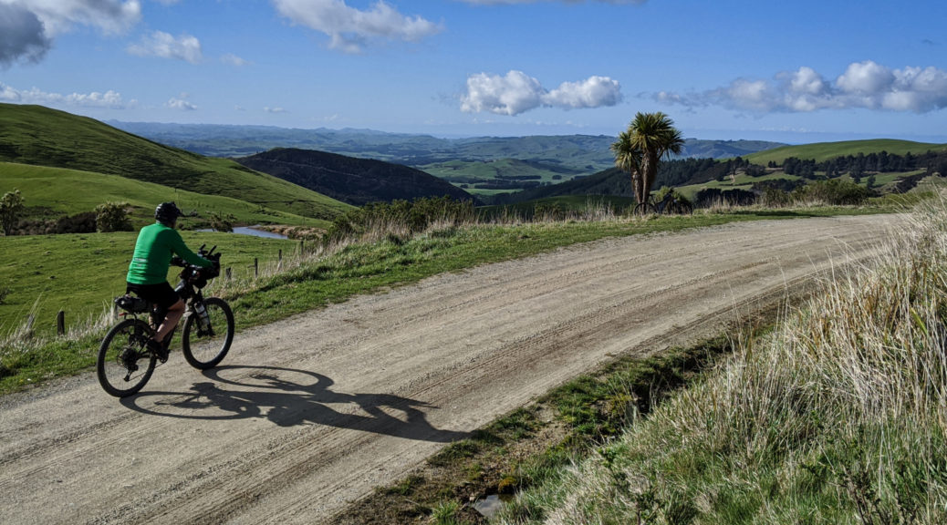
Near the summit of the main road, I turned off north and continued to climb before eventually dropping to Canaan Downs. So many rocks everywhere in the paddocks, and a little native bush to ride through. It looked a sweet place to camp as the downs opened up, and I found a cheeky bit of singletrack to ride, confusing the sheep and avoiding orienteer scouts, before the Rameka Track started.

A very old track, as far as NZ European history goes, that’s been revitalised – it was great to work my way down to sea level. A loaded rigid bikepacking bike may not the best stead for it, but I was thrilled with the descent through the bush. Occasionally the views opened up, but I was having too much fun to stop much.

Before long I’d lost all the altitude and was rolling into my Airbnb on the outskirts of town; a top day getting to Takaka and moving the legs a little before the weekend’s challenge.

Sunday Scouting – Rotohiwi and Te Uri

With two people independently suggesting I alter the start of HBAT through a farm to a long stretch of gravel, I was certainly going to take a look. Andrew and I drove south through a frosty Sunday dawn to the south of Hawke’s Bay, leaving the car at a country school where it definitely had not warmed up.

Lumpy to start with, I was soon hoping for the climbs as whizzing down was decidedly chilly. Gravel appeared and we rode through a small herd grazing the verges – while now green, there’s still not a lot of feed around. Chatting to the farmer watching his stock, in what became a familiar routine, a few minutes in Andrew was recognised – despite having left the area fifty years ago. It was a very chatty day as everyone we met seemed to have some connection to my riding buddy.

Getting a bit higher, looking north.

Finally the climbing started in earnest and I began to warm; another dip must have been steep, making use of what I now know in some parts is called “traction seal”. Strange to have a name for those short patches of tarseal that appear on steep parts of gravel roads in the middle of nowhere. More farmers to chat to (no, I’ve not seen your lost heading dog – worth as much as my bike) including the one who was generously giving us access, and with no concerns of routing HBAT, through his land. Climb, climb and a little more; onto the farm track, pleasingly dry, a steeper gradient and then over the watershed to bomb past the airstrip.

Andrew heading for the airstrip; obviously a windy place, the breeze was light.

Through to Te Uri Rd, the sealed section was short before we reached the charming community hall and more gravel winding flatly and pleasantly for a few kilometres. That didn’t last as we rose towards the watershed again and headed back into Hawke’s Bay. The section through pine forest had been devoid of sun for some time and was sloppy, giving my bike and me a nice splatter effect for the small price of slightly less efficient pedalling.

Out in farmland again, the view opened up and we stole our first glance of the Pacific for the day.

The climbing continued a while longer.

Nearing the thirty kilometre mark, we’d already managed a thousand metres of climbing – and not too unpleasant it was either at a steady pace with plenty of rests. This paid off with twenty kilometres down, steep at first to get to the plains and more gradual as we followed the watercourses towards lunch. Getting closer to places Andrew’s family had more direct association with, ideas for looping further south and back north abounded – hopefully only a few weeks before those are explored.

Mangaorapa valley – we’d drop down and ride right to left, before following the Porangahau River through towards that glimpse of ocean.

Refuelling as ever at the wonderful Flotsam & Jetsam coffee cart (horse float really; I’m told the coffee is top-notch, but I’m taken by the home baking), was another opportunity for yarns in the sun of old times and old families of the area. Families of eighteen and twenty-one children!

Scouting of new routes done, we were to return to the car following some of last year’s route in reverse. It was perhaps a bit mad riding up the very hill that hair-raisingly dumped riders right into town – Andrew’s chain thought so as one of the side plates broke in two. That fixed, we were left to spin for half an hour to the ridge. I was going to leave this reverse bit out for the more sensible coastal and flat option; but no way, perish the though, the ridge riding and views were sublime. What’s another hill amongst all the others?

Dropping off the ridge, the gravel stretches and stretches.
Enough of Route 52 done, I saw my first newborn lambs of the year. I was a little perplexed by Andrew stopping behind me and running off into a field; turning and catching up, we were off for a bikepacking first more me – turning a sheep. I now know that ewes with multiple pregnancies can sometimes struggle to get back on their feet from lying down – and perish overnight. Sheep and multiple lambs saved, until next time it lies down in the sun, it wasn’t far back to the car – past dozens more newborn lambs out in the warm afternoon sun.

A stunner of a day, and that suggested route is definitely going in HBAT – it was fantastic. More remote, plenty of hills and rural views. In a sudden moment of inspiration, a scheme to change the start point struck me – more things to organise and ways to optimise this year’s route… A big thanks to Andrew for the contacts, riding company and chat; much kudos too – if I’m still riding up these sorts of hills when I’m knocking twice my current age, I’ll be well pleased and fortunate to be in such health.

Wharerata and Old Mahanga Rd

Decidedly uncomfortable for the first half hour pre-dawn, I may have gone numb for the second as the relatively flat valley floor riding continued. After seven I warmed as the sky lightened and the hills started. But I then climbed into a layer of fog and was chilled again. The stars disappeared from view as the increasing light revealed what I already knew – it was downright frosty.

It was probably warmer among the mob of sheep waiting to lose their fleeces. Until they lost their fleeces.

The level of fog was stark as the sun rose and slowly crept down the hills opposite.

No stopping at the Tiniroto Tavern this time, far too early. Realising I’d not ridden Ruakaka Rd from the south, I thought I’d better if I want to put it in this year’s HBAT. Ruakaka is very good and there were no vehicles to be seen; the most activity I saw was some farm-kids feeding their horses. The climb back up to Tiniroto was not as big as I remembered from bombing down it in February, that aided me in getting to the sea-level outskirts of Gisborne by noon. I’m glad I’ve found a couple of gravel alternatives through this way; the sealed Tiniroto Road has become rather boring to me now.

The gas station at Manutuke was the lunch stop, and a disappointing one at that. One thing in the pie warmer, and I had to ask what it was. Turns out a BBC is a Beef, Bacon & Cheese Roll – a glorified sausage roll that may have, to look at it, been kept warm for the best part of a week. The friendly roaming dog didn’t even show interest in it. An hour of lazy, flat valley floor riding with the sun on my back, no wind and no traffic was an easy start to the afternoon – before the lifestyle blocks turned to sheep and beef hill country, and pines started to appear.

Back on gravel, it was a bit of a mess. Strangely, there were work crews out on a Saturday fixing up the road from logging truck damage. I had quite a chat to one of them, trying to explain and counter their disbelief as to why I was riding a loaded bike up there. Ignoring roadsigns of questionable legality (the gates were open after all), deeper into the forest I climbed.

Pleased and surprised, I found swathes of native bush on the eastern side of the road. There was no-one to be found and I had the place and views to share only with wood pigeons. Glimpses of Hawke Bay to the south on occasion had me looking toward Mahia, where I hoped I’d make it before I ran out of energy. Ticking along casually, I was well aware I’d not ridden a loaded bike for six months and I may be out of gas before expected.

Dropping, I popped out in the middle of a section of highway I can’t remember ever being on – bit odd considering it’s only a hundred kilometres from home. A short section of that to Wharerata took me past a lookout I’d heard much mention of.

Poverty Bay with Gisborne on the left, and Young Nicks Head in the centre.

Turning south, gravel ridge riding didn’t provide much in the way of views as it was mostly pine-lined. After ten kilometres, the road slid closer and closer to the Unformed moniker in Unformed Legal Road. With a little hike-a-bike around and over treefall, the fast-approaching sunset loomed larger in my mind. Out of the forestry and over a gate, I was into the farmland that would take me down to Mahanga.

My, where did all this mud come from?! Confronted with vast patches of it, suddenly I was going to be out well after dark. Oh well. However, it seems this is quite different to the wheel-binding mud of southern Hawke’s Bay. It was hardly slippery, and not at all sticky. Not having rained for a couple of days, when one couldn’t ride around it on the grass, it was negotiable. Slowed, but not too much, my crossing to the eastern (coastal) side of the hills was a continual balance of risk and reward – slow through the mud, or riding the narrow grass verge on the edge of the hill.

As the sun sunk, I was pleased to find myself riding with this guy again.

Off the ridge line, the mud lessened markedly and riding down the track quickened.

Close to the coast now, looking north of Gisborne.

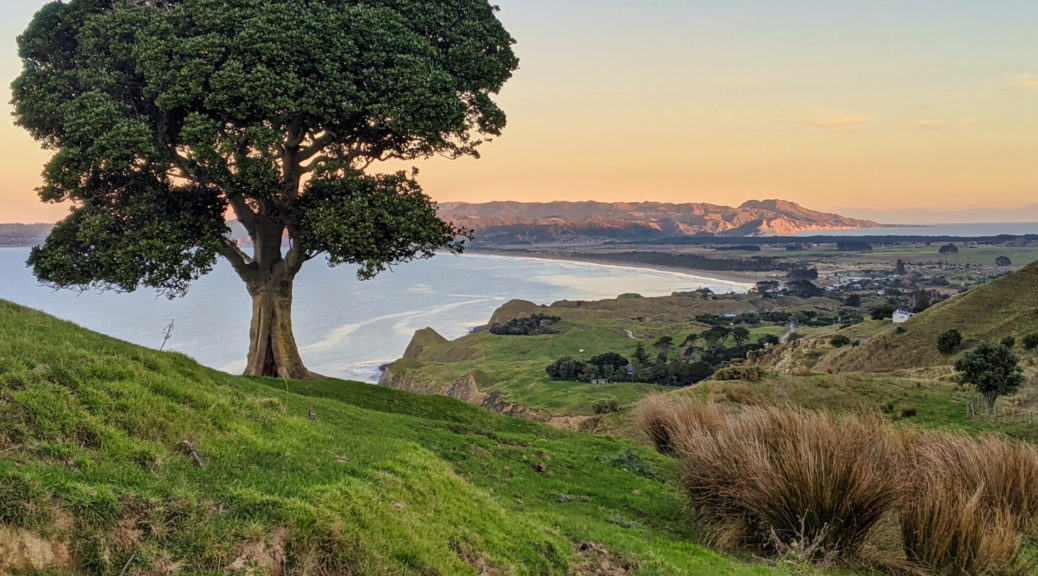
Dropping down to Mahanga as the sun sets on Mahia Peninsula – I was pretty sure I’d make it across the isthmus just before dark.

Indeed I did, and mightily pleased I’d not be spending the rapidly cooling night in a ditchbound bivy bag. I was pretty had it, and was surprised to find myself more than a little queasy – it hadn’t been at all hot, yet my classic end-of-a-long day symptoms appeared. Thankfully they are easily overcome and I rested well.

Closing the loop back to my car was a far simpler affair – only eighty-odd kilometres, all of which I knew, much of it lovely gravel backroads. Rest seemed more important than dragging myself up a big climb as the sun rose, so I slept in a little and watched the sun rise over the lagoon. Climbing Tunanui Road didn’t seem as steep from the east; even so, I was a little disappointed the Nuhaka store wasn’t open at nine – an ice cream would have gone down well.

Hereheretau Rd however had a far steeper climb riding it in the reverse direction. No matter, it was conquered and the cruise down alongside the Makaretu was sublime and the climb out of the valley was really quite nice.

Strange to be back at the car around midday, there was plenty of time for eating, driving home and even cleaning the mud off my bike. Seemed somewhat indulgent, a waste of good fine winter riding weather. Another successful HBAT scouting trip done, this year’s route is slowly coming together and I always love riding the hills of northern Hawke’s Bay.